AR | navigation app
Route2GO
Accessible Route Finder
Project type
Independent School Project
My part
User Interview
Competitive Analysis
UI/ UX Design
Video Prototyping
Tools
Figma
Photoshop
iMovie
Duration
1 Month
Background
In the U.S., over 30 million individuals live with mobility impairments, often facing challenges like inaccessible sidewalks, steep ramps, and construction zones.
Problem
Traditional navigation apps often focus on the shortest routes for those without limitations, overlooking the needs of others and restricting access to essential services.
Who is impacted?
Pedestrians with mobility impairments may experience permanent, temporary, or situational challenges.
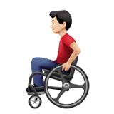
People in wheelchair

Injured people

Eldly people

Travelers with luggages
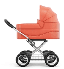
Parents with baby stroller

Walking on slippery sidewalk
This one-month school project included interviews, competitive analysis, brainstorming, storyboarding, and a video presentation to highlight the solution.


Conducted interviews with 4 participants experiencing permanent, temporary, or situational mobility challenges.
4 Participants

Participant Goals
Navigate to the destination while avoiding obstacles like inaccessible sidewalks, steep ramps, and construction zones.
User-friendly devices with intuitive interfaces that simplify navigation.
Offer reliable and real-time navigation that adjusts for changing conditions, such as construction or weather.
Performed a competitive analysis of Google Maps and the Seattle Accessible Route Planner.
Google Accessible Transit Routes
A new feature in the Google Maps app allows you to tap "Options" and select "Wheelchair accessible" under the Route options as a new route type.
Pros: Offers potential accessible routes for pedestrians.
Cons: Destinations are restricted to areas accessible by public transportation.

Seattle Accessible Route Planner
It is an online tool leveraging Seattle GIS data to assist travelers with mobility impairments in navigating the city's sidewalks, curb ramps, and street crossings.

Pros: Offers detailed information to help users assess sidewalk conditions and plan routes effectively.
Cons: Limited to desktop use, lacks mobile compatibility, and requires a learning curve due to its complexity for route planning.
I created three storyboards to present various user experience concepts to participants and gathered their feedback.
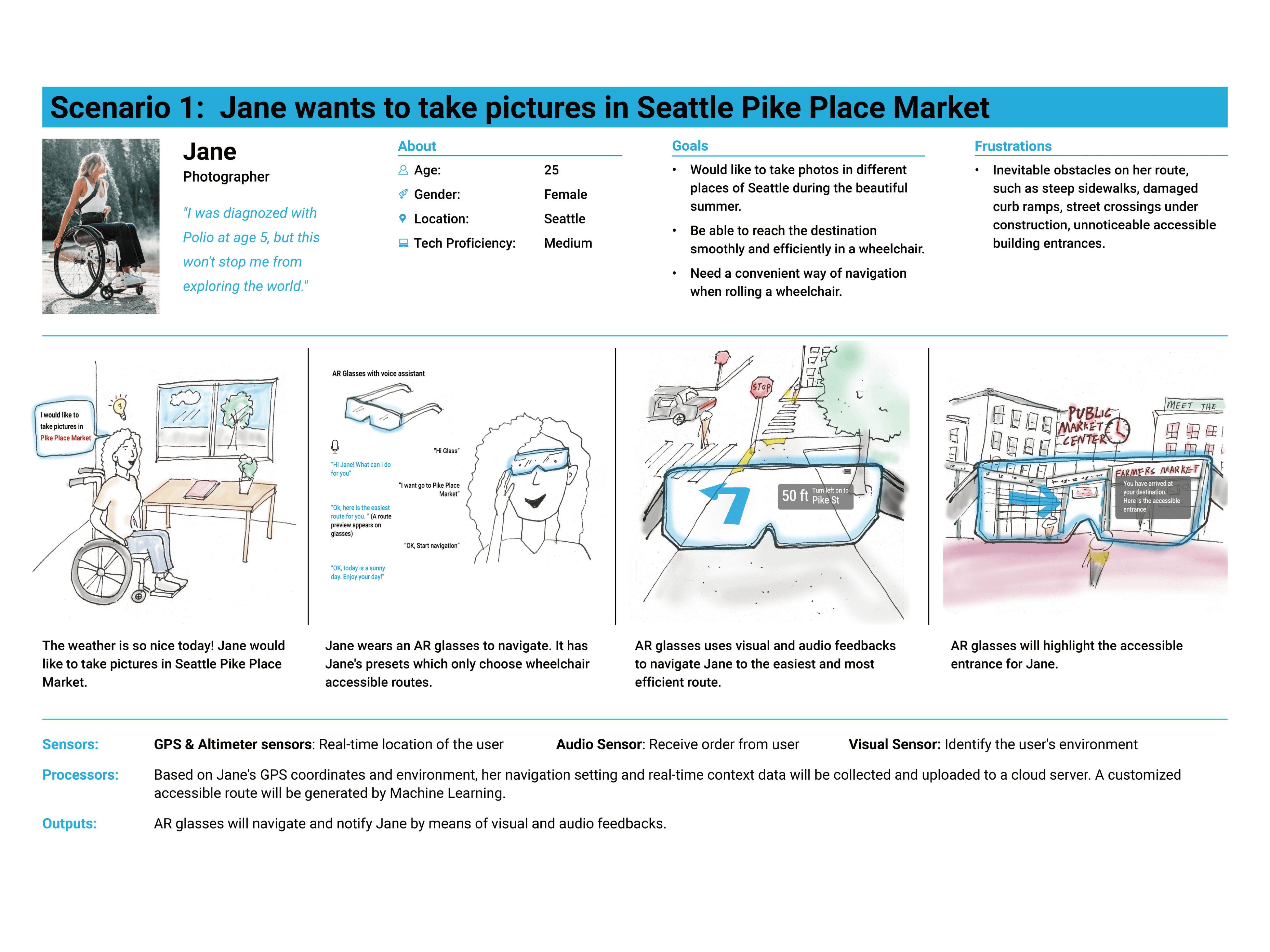
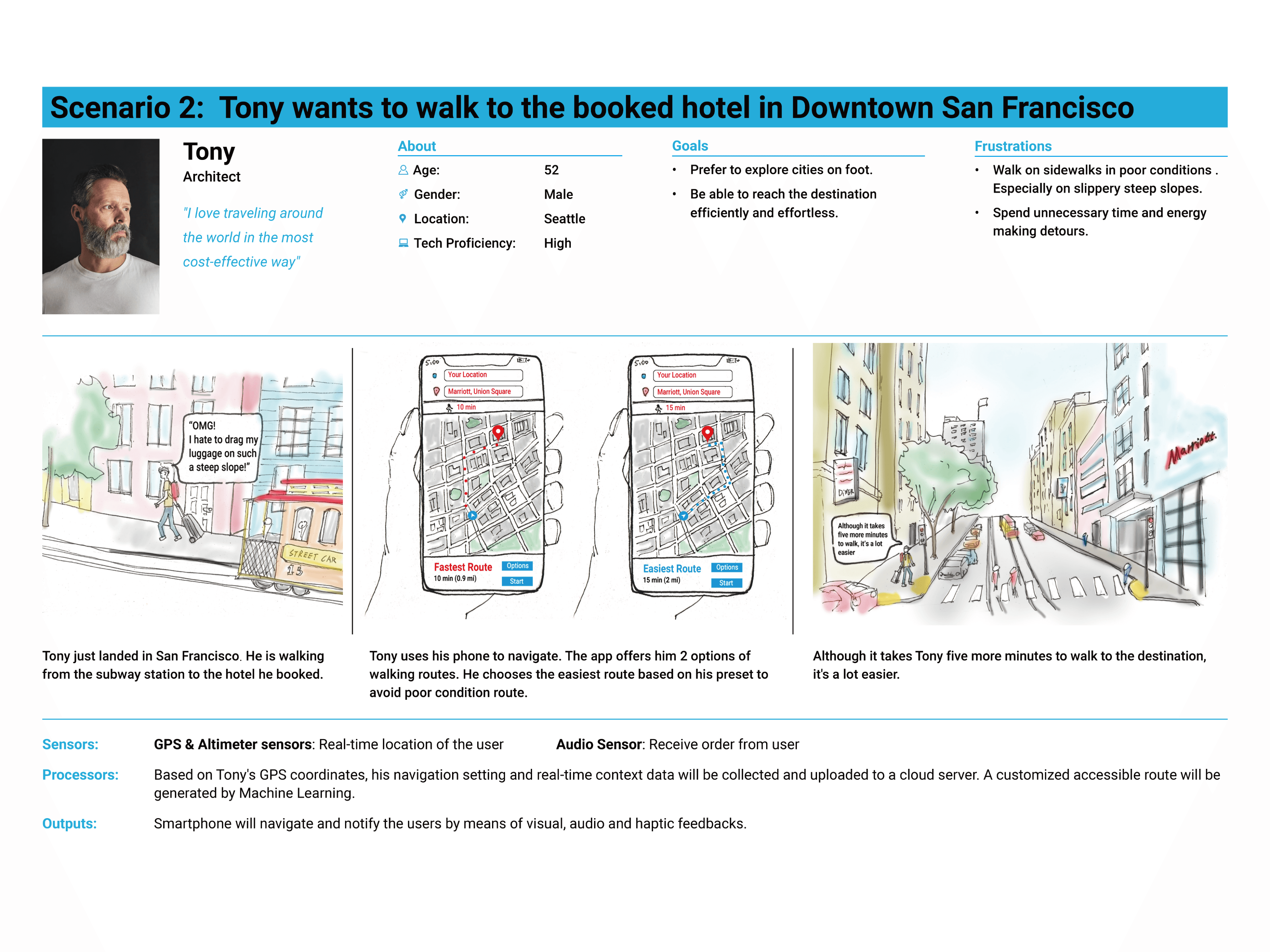
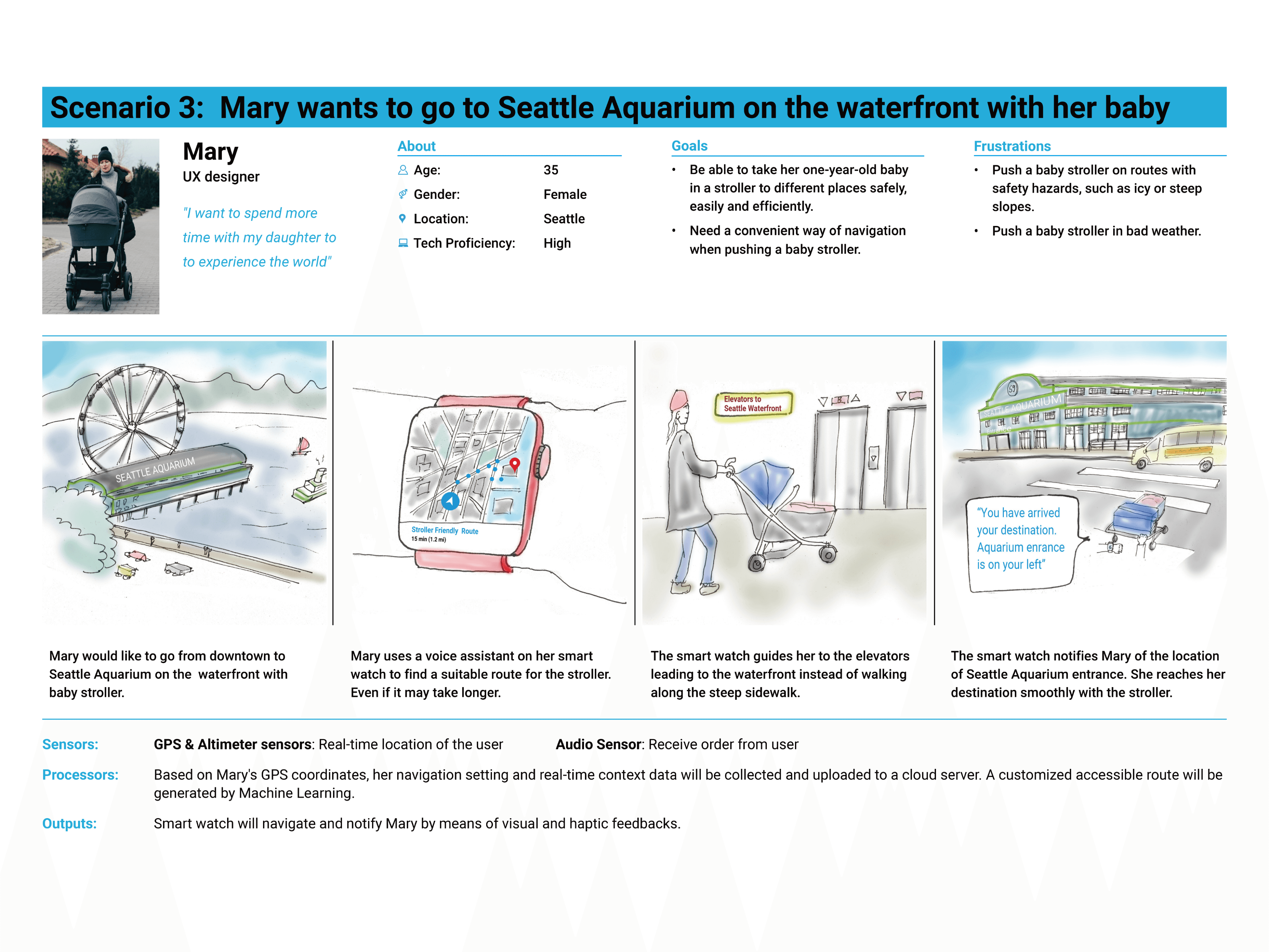
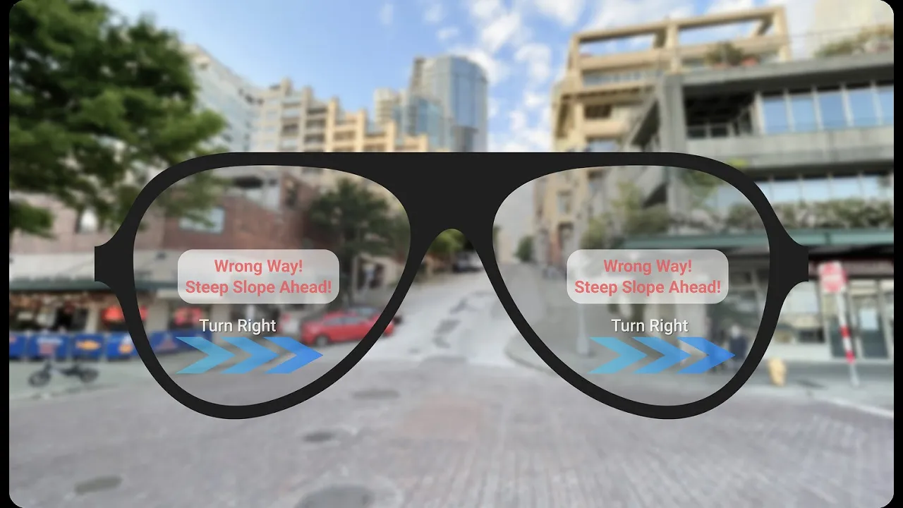
After incorporating participant feedback, I decided to create a multi-modal navigation app to provide optimal routes for pedestrians with mobility impairments, accessible on mobile phones, smartwatches, and AR glasses.

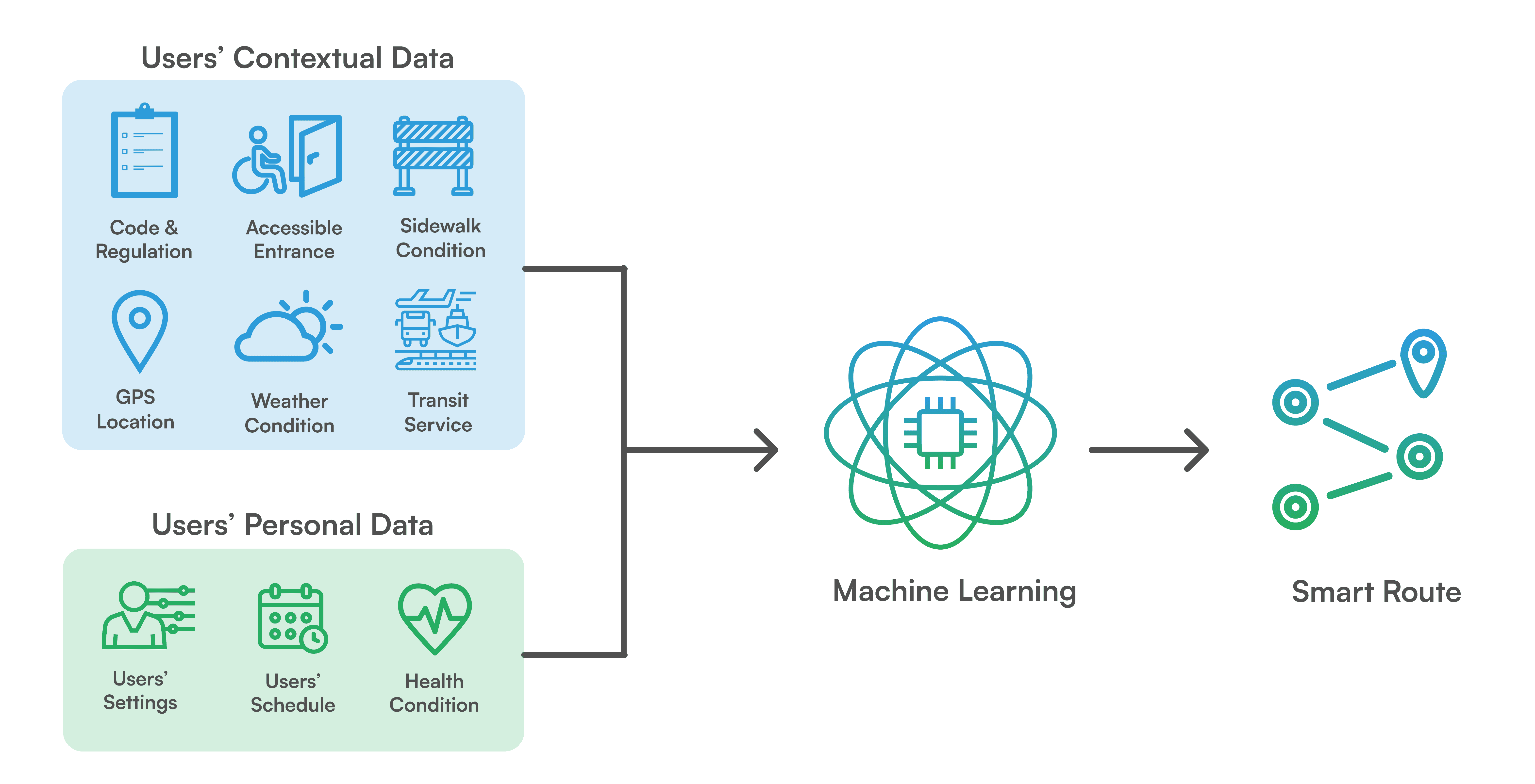
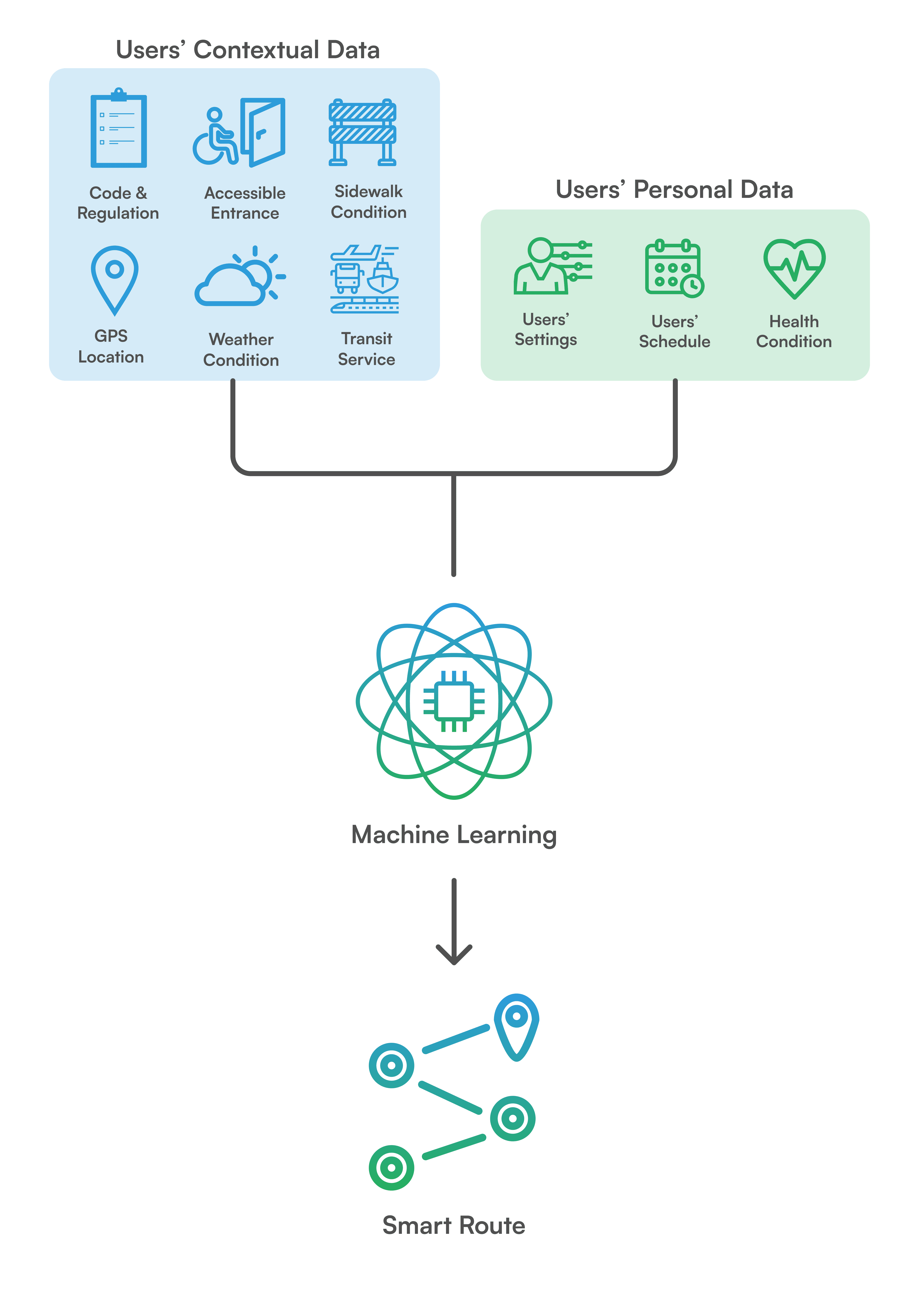
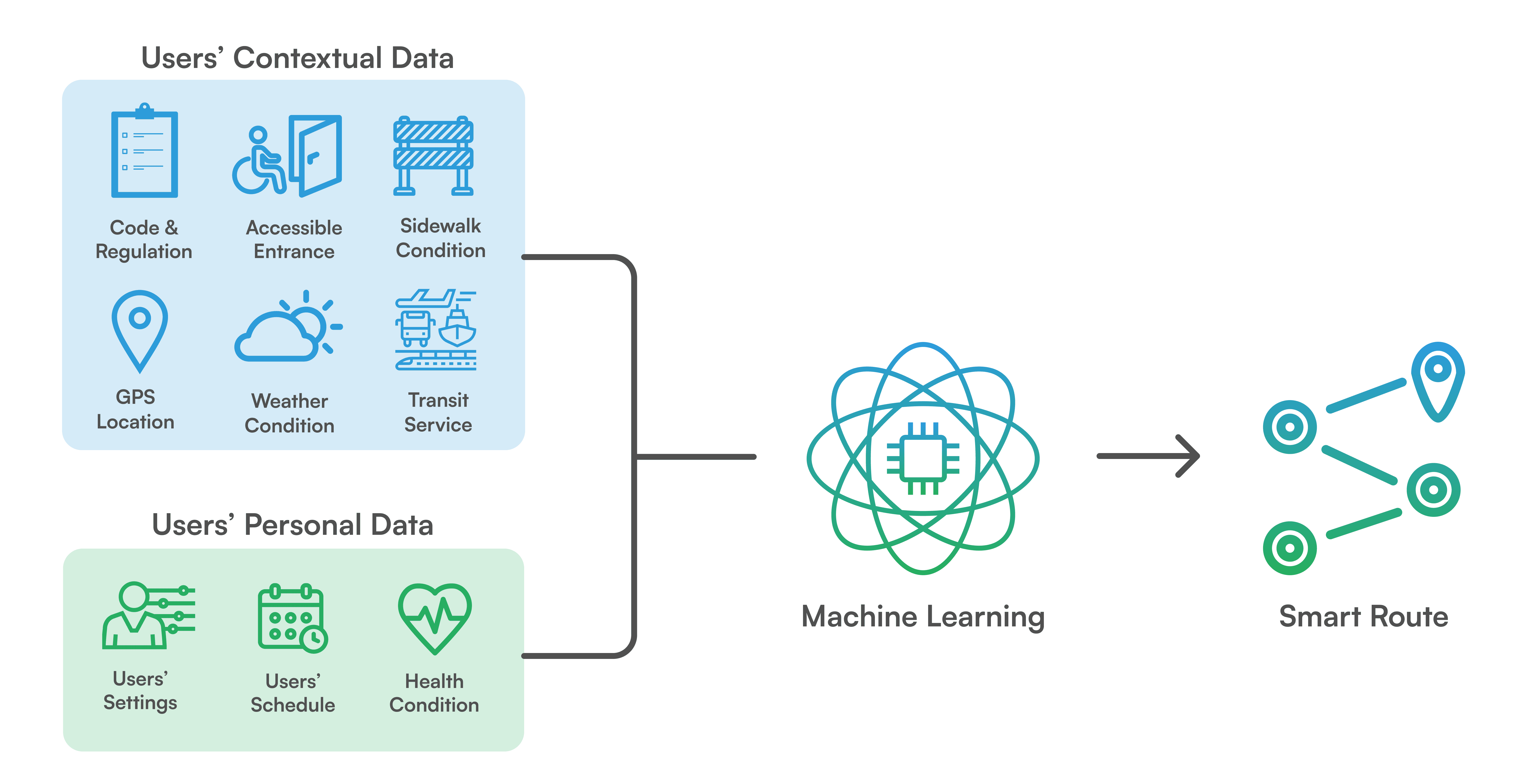
How it works:
Machine learning algorithms analyze user data and context to generate customized routes, prioritizing suitability over shortest paths, with a manual override option for shortest routes.
Experience map
I designed an experience map to outline the concept of customer journey maps across three products.


What went well
Research methods | Concept testing

If I have more time
Perform usability tests across various devices to evaluate the design's effectiveness and improve the prototype accordingly.

Takeaway
At some point in life, everyone may encounter varying levels of disability, making it essential to prioritize inclusivity when designing experiences.